

When I was planning the trip, I found out that there are two main routes here: the classic one along the ancient trade route, and the shorter one. I chose the classic one: I wanted to feel the spirit of history.
The further I moved deeper into the Pamirs, the more I was amazed at the resilience of the locals. There is incredible natural beauty all around, but life here is not easy.: jobs are tight, and the infrastructure is almost undeveloped.
The first point on my route was the bridge over the Batrang River. I left the car in the parking lot and went to Dzhizevdar – I planned to spend a couple of days there. I noticed several lakes on the map – I was curious to explore them.
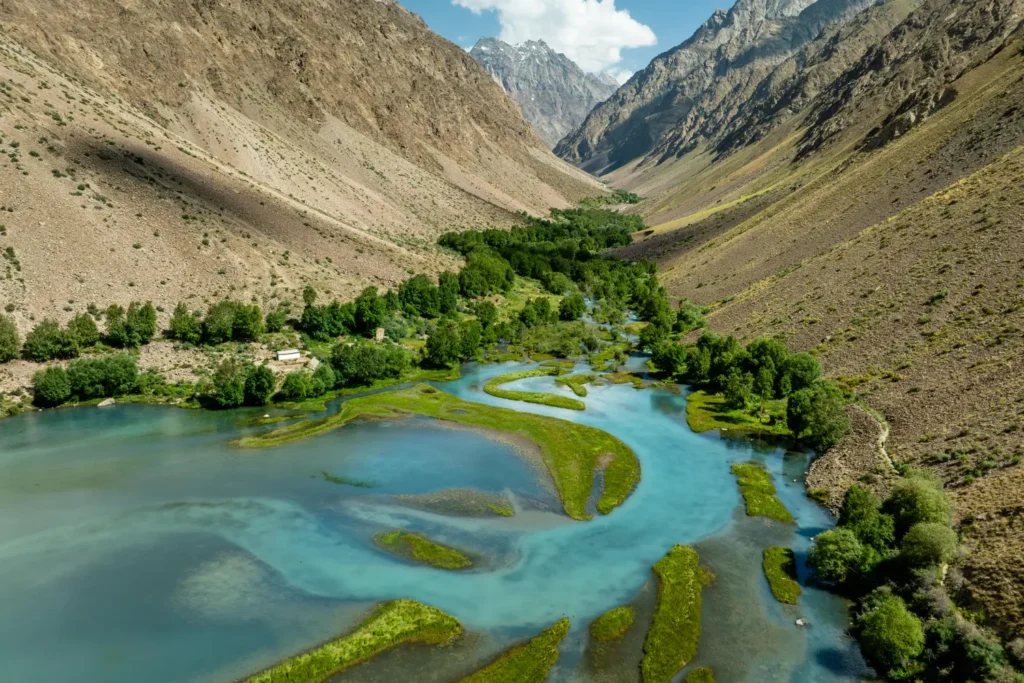
Photo: Marat Nadjibaev
Then I moved towards the village of Barchidiv. Along the way, there were small villages, and the landscape gradually changed: vegetation became less and less. In some places, the remains of cars that had fallen into the river could be seen. This served as a silent reminder to drivers: you need to be extremely careful here – help may not come immediately.
Barchidiv turned out to be one of the last and largest settlements in the area. It is located in the gorge of the Murghab River, and it is from here that the path to the Sarez Lake begins. I managed to get there before dark – I needed to rest properly before going to the lake the next day.
Lake Sarez is a place with a complicated history. It was formed after the earthquake, when a blockage occurred and the village of Usoi appeared under the water. Only those who were not in the village at the time escaped. The lake got its name from the neighboring village of Sarez. When the water began to fill the gorge, people were forced to leave their homes.
The lake is located at an altitude of 3255 meters. Mountain winds often rage here, raising high waves. Boats cannot go out on the water until there is a calm. I was warned about this in advance by the staff of the Ministry of Emergency Situations, who are constantly on duty in these places.
After the rest, I had to go down from Barchidiv to the neighboring village to get fuel. From there I went to the tributary of the Bartang River, the Gudara River. The final point of the route was the village of Gudara. There was a difficult stretch of road waiting for me – I had to enlist the help of a tractor driver. In one place, the river overflows and floods the path.
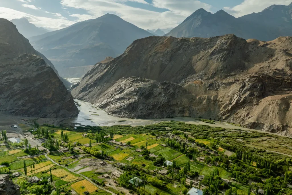
Photo: Marat Nadjibaev
From Gudara to Karakul there is more than 130 km of deserted road. There are only rare shepherds and tourists. Locals call this section the “Back Door”: it allows you to shorten the path along the Pamir highway.
Karakul is the most deserted part of the Pamirs. There is only about 20 mm of precipitation per year. The color of the lake is striking: instead of a dark shade (as the name suggests), the water shimmers with ultramarine, blue and greenish – it all depends on how sunlight is refracted on the surface.
Interestingly, in the 19th century, British explorers who visited this place named Lake Victoria in honor of the queen.